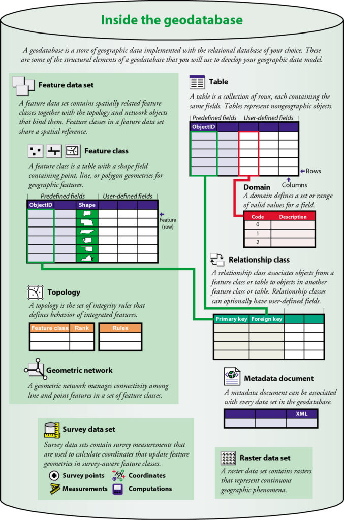
GIS design involves organizing geographic information into a series of data themes-layers that can be integrated using geographic location. So it makes sense that geodatabase design begins by identifying the data themes to be used, then specifying the contents and representations of each thematic layer.
This involves defining:
- How the geographic features are to be represented for each theme (for example, as points, lines, polygons, or rasters) along with their tabular attributes.
- How the data will be organized into datasets, such as feature classes, attributes, raster datasets, and so forth.
- What additional spatial and database elements will be needed for integrity rules, for implementing rich GIS behavior (such as topologies, networks, and raster catalogs), and defining spatial and attribute relationships between datasets.
That’s why organizations requires an enterprise GIS geodatabase, InfoGraph offers the following Geodatabase specializations:
- GeoSpatial Data Modeling, Geodatabase Design.
- Spatial data modeling, spatial and topology business rules.
- Network data models.
- Geo-spatial data migration, validation, auditing.
- Metadata development.
- GIS data maintenance workflow design.
- Geodatabase Versioning Plans.