Save water. Save time. Save money. Intelligent water management begins with GIS.
Saving hundreds of thousands of dollars
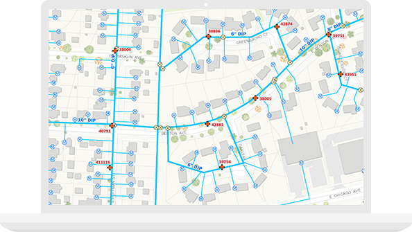
To address aging infrastructure, leaks, and the potential for severe main breaks, White House Utility District in Tennessee provides wide access to GIS data and water-loss apps. Now staff can quickly isolate underground leaks, respond faster to main breaks, and prioritize capital improvement spending based on GIS data.
Intelligent water systems start here
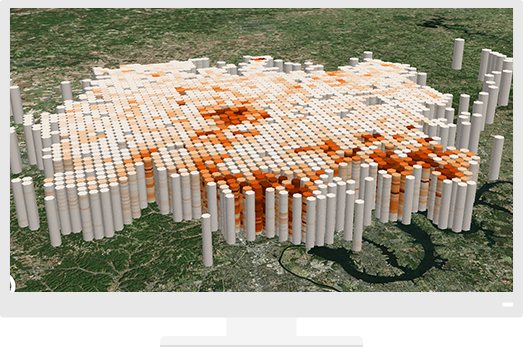
Location influences all aspects of managing water—from protecting a sustainable water supply to delivering safe drinking water. Advanced mapping and spatial analytics reveal relationships and patterns, answer complex questions, and help users make informed decisions in both the office and the field.
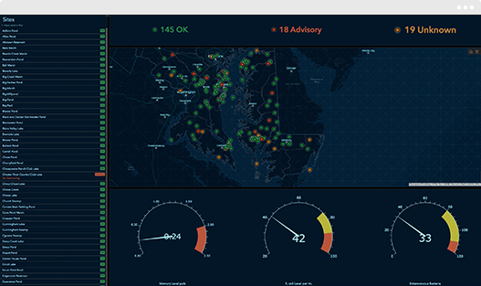
Analytics
Discover relationships in your data, such as areas of high risk due to pollutants or aging infrastructure. Detect problems before they can occur.
Workflows
Standardize and improve daily processes between the office and the field. Share information with anyone, anywhere, anytime.
Collaboration and engagement
Share detailed maps and reports with internal and external stakeholders. Transform meetings, hearings, and community engagements with interactive apps.