Professional GIS Services
Comprehensive geospatial solutions designed to maximize your GIS investment and drive business value through GIS.
Enterprise GIS Consulting
Maximize the value from your GIS investment through a clear enterprise roadmap. We help organizations develop comprehensive strategies that align GIS capabilities with business objectives — identifying quick wins and long-term opportunities. Our consultants have guided government agencies, utilities, and private enterprises through every stage of GIS maturity, from first deployment to full organizational adoption.
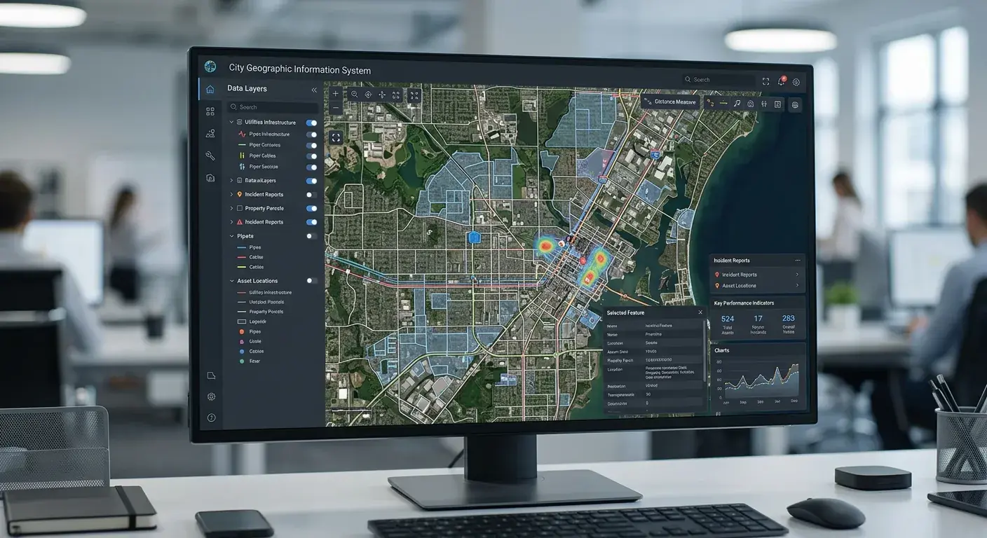
Application Development
Build and manage custom GIS solutions deployed on premises or in the cloud. Our developers create tailored applications that solve real operational problems — not generic tools you have to work around. From field data collection apps to executive dashboards, every solution is built on the ArcGIS platform and designed for the people who will use it daily.

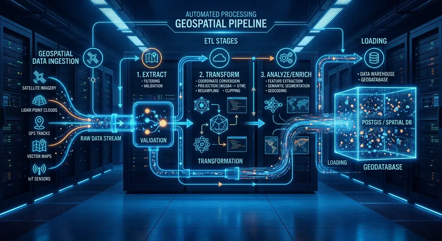
Data Automation & Processing
Build the right foundation for your GIS implementation by enhancing the quality of your geospatial data. We streamline data workflows and ensure data integrity across your organization. Whether you're migrating decades of legacy records or building real-time processing pipelines from scratch, we eliminate manual bottlenecks so your teams can focus on analysis instead of data wrangling.
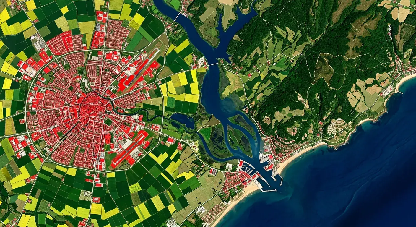
Remote Sensing & Image Processing
Satellite and aerial imagery hold answers that ground-level data alone cannot provide. We process multispectral, LiDAR, and high-resolution imagery to support land classification, environmental monitoring, and change detection across large areas. Our team has delivered remote sensing projects for agriculture, urban expansion tracking, and natural resource management throughout the region.
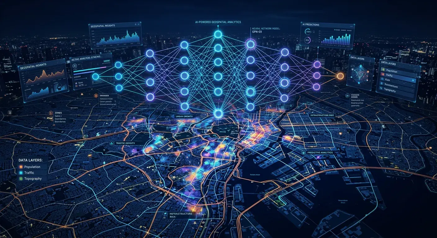
Geospatial Intelligence & AI
Turn location data into actionable intelligence at scale. We build custom language models and AI-driven geospatial workflows tailored to your organization's data and requirements. From predictive analytics that anticipate infrastructure failures to natural language querying that lets non-technical staff interrogate spatial data directly — we deploy AI where it creates measurable operational impact, not novelty.
Ready to Get Started?
Let's discuss how our GIS services can transform your organization. Our team of experts is ready to help.