Better understand the earth’s complex systems with location intelligence
A platform for sustainable development
Esri’s ArcGIS platform equips you to better plan, execute, and report on sustainable development in any situation. Achieve goals faster with scientifically grounded system that precisely measures growth and provides the tools to share progress with the community.

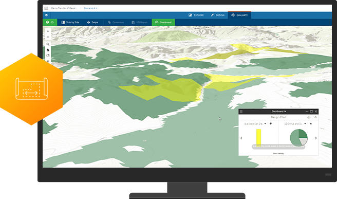
Plan effectively
ArcGIS workflows maximize the impact of projects by optimizing the distribution of resources. Get insight about where activities can be focused to best reach targets outlined in global Sustainable Development Goals.
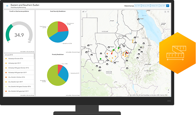
Measure impact
A location intelligence platform precisely measures results so you can justify expenditures and secure future funding. Take advantage of analytics that precisely assess program effectiveness and enable you to share it with all stakeholders via dashboards and map-based reports.
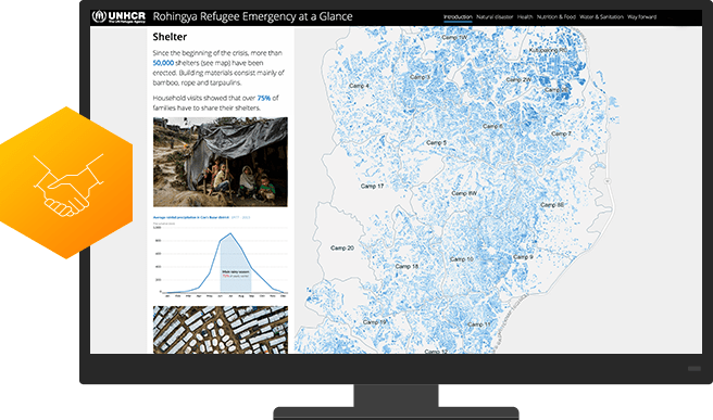
Strengthen partnerships
ArcGIS is as a collaboration hub that facilitates partner/client interaction. Leverage easy-to-configure apps, interactive maps, and authoritative data to engage grantees, beneficiaries, donors, and the public.